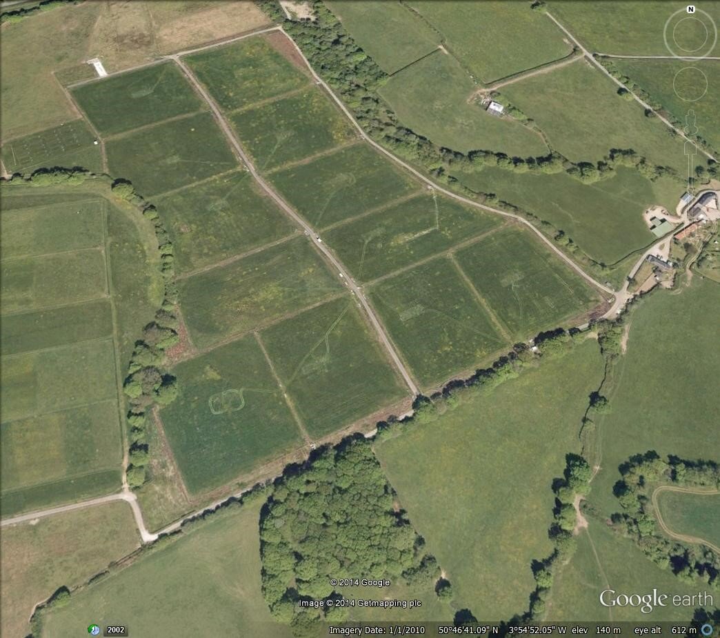
the original 12-plot design
weirs from a drained plot
aerial view of rowden plots
Long-term Drainage Manipulation
The Rowden drainage facility was established in 1982 at Rothamsted Research’s North Wyke site in Devon. This unique facility initially provided 12 - and subsequently 14 - grazed, hydrologically-isolated plots of 1 hectare each, with 50% drained and 50% undrained. Whilst the early emphasis was on the effect of drainage on herbage and grazing animal output, the plots facilitated unique studies on nutrient transformations/movements and water quality, and remain a key facility at the North Wyke site. The Rowden Plots have been used to study grassland carbon sequestration and greenhouse gas emission under contrasting treatments, and provided the basis for early integrated scaled-farm (farmlet) studies.
Current Research Aims and Experimental Design
The current research being undertaken on the Rowden drainage facility is part of Rothamsted Research’s Achieving Sustainable Agricultural Systems (ASSIST) project. This long-term research aims to develop innovative grazing livestock systems which minimise inputs whilst maximising yield, and build resilience to future environmental change. A variety of swards are being compared under different grazing management regimes using ewes and lambs. The swards are:
a nature-based, multi-species sward
an agri-tech soft fibre grass sward
a permanent pasture (business-as-usual) control
Responses to the grazing system are being monitored via the following parameters:
soil health and biodiversity
greenhouse gas fluxes
water infiltration and quality
pollination and pest control
performance - forage yield & nutritional value, weight gain in livestock, botanical composition, sward persistency
Research on the Rowden Plots is complemented by long-term biotic and abiotic monitoring taking place on adjacent plots belonging to the Environmental Change Network (ECN).
example of a controlled cell-grazing plot
multi-species sward (foreground)
Site Details and History
cattle on plots, with drainage weirs in foreground
Download further information on the site, including soil properties and a full history of the plots.
Download an infographic of the ASSIST project for which the Rowden Plots are a constituent part.
Data Availability and Soil Samples
Meteorological data from the site is available at hourly intervals going back to 1992. High resolution hydrological data is available for each plot from 2004 onwards, though with a data gap between 2013-2016. Between 1982 and 2004, data were collected using continual chart loggers. This has since been digitised and kept on a dedicated SharePoint site at Rothamsted. Water quality data has been collected since 1998, and vegetation surveys have been carried out intermittently (and are ongoing). Soil samples have been taken from the Environmental Change Network plots every five years since 1995, the majority of which are stored at North Wyke. All data are archived digitally and are freely available upon request.
If you are interested in accessing the plots for research purposes, or using the site data, please contact Jane Hawkins.


